Decisions
1. History
New Orleans was settled in 1718 by Jean-Baptise Le Moyne de Bienville in part of the conflict for control of land in North America. The area was considered ideal for the proximity to the Mississippi River and having a connection to the sea, enabling easy food production and easy trade through the Gulf of Mexico (Morris 2000). The original site of New Orleans, now the French Quarter, was on a high ground, chosen by the French as it was the highest and driest location, amidst swampland.
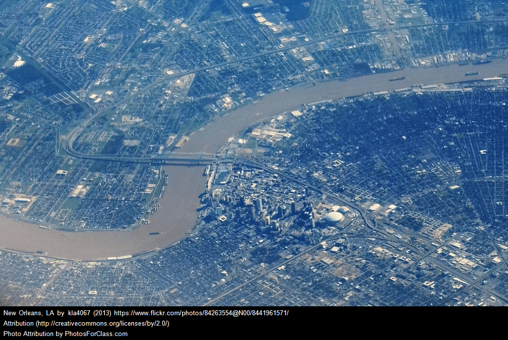
To accommodate further growth of the city, the swampland surrounding the city had to be drained. This was achieved by the construction of 4-foot-high earthen levees in 1722, which was completed in 1724. The completed system of levees and ditches spanned nearly ten miles, of which resulted in a sinking of New Orleans to lower than sea level. This sinking effect is responsible for parts of present day New Orleans being, on average, four feet below sea level (Below et al. n.d). This is demonstrated in Figure 1.

In the 19th and 20th centuries, the city repeatedly became a victim of hurricanes, however, the residents did not recognize hurricanes as a main problem of New Orleans. They considered swamp lands around New Orleans as a major factor that stops city from development. As a result, the situation changed in 1910 with the help of inventor and engineer Albert Baldwin Wood. Wood’s design of pumps and channels drained New Orleans and its adjacent swamp areas to Lake Pontchartrain. As a result, this led to the expansion in areas that were much lower than sea level.
2. City expansion infrastructure (Pumps and levees)
New Orleans, surrounded by the Mississippi River, its wetlands and swamps is one of the most biologically productive and interesting ecosystems of its time. As a vast nursery for juvenile shrimp, crabs, red-fish, sea trout, and dozens of other important species, the wetlands provided endlessly to its residents and became a vital commercial resource. These coastal wetlands also acted as a natural barrier to hurricanes from the Gulf of Mexico, absorbing the storm surges like a sponge.
Annual flooding of the Mississippi had occurred for thousands of years; depositing silt which maintained the wetland soils, 75% of which come from over the river banks. This created a natural high ground around the river, for the expanding city to grow. New Orleans was expanding along the Mississippi River, but some cities were beginning to expand below the sea level. Rain was discharged into the swamp, but in order to alleviate the increasing threat of flooding, the city began to build levees and canals to quickly discharge groundwater and river water from the Mississippi River into Lake of Ponchartrain. Since then, how to quickly discharge rainwater from the city to avoid flooding had become a difficult task that New Orleans must face in order to survive. This problem still entangles this city until now.
The innovation of drainage technology brought the expansion of New Orleans to the Back of Town Swamp. These sponge-like ecological barriers were subsequently drained at the beginning of the 20th century for the development of housing construction. Loss of water and the breakdown of organic matter in the soil contributed an average land level drop of 3 feet.
In the later of 19th century, the city expanded to where it was a swamp. Many sophisticated canals and pumping stations were established to prevent the city from flooding. There are four main solutions for flooding, which are main stem levees, flood-walls, channel improvement and principal tributary basin improvement. The construction of these flood-walls turned the area between the Mississippi and the eventual construction of Lake Pontchatrain into a bowl, a failure of which would cause devastating flooding of the city (Campanella, 2019) – see Figure 2. By 2005, the drainage system of New Orleans contented 418 km canals, 2438 km underground drain pipes and 148 pumps stations.

At the end of the twentieth century, the wetlands of New Orleans had largely disappeared, replaced by complex drainage networks: underground water pipes, underground canals, above-ground canals, and pump stations. These engineering facilities are constantly running, maintaining the stability of the city and the prosperity of downtown day after day.
3. Blowing up levees
Why did they blow up the levees?
In the summer of 1926 through to 1927 the central Mississippi basin experienced heavier than usual rainfall causing a drastic increase in water levels along the Mississippi river to levels that still hold the record in some areas. This resulted in banks bursting further upstream from New Orleans killing 500 people and swamping in excess of 1 million homes. This raised concerns for New Orleans as the local elite believed the same thing would happen in the heart of New Orleans. There were often arguments over whether to allow a particular levee to break naturally or dynamite it. Blasting a gap prevented the entire levee being washed away, and reduced the risk of flooding upstream.
What do levees do?
Levees are tools used to prevent rivers from flooding cities in a storm surge and maintain water levels. It is a natural or artificial wall that blocks water from going a certain area. If it breaks, it can be disastrous. A good levee should:
- Withstand catastrophic natural disaster such as the kind of catastrophic storm that only occurs once in 10,000 years.
- Focus more on directing the water into specially made rivers, dams and other flood-water absorbing system rather than big barriers that attempts to block the flood-water.
- Use tough, synthetic textiles to better anchor earthen levees, preventing soil movement and water penetration.
- Be monitored at a regular basis to ensure the structures’ health.
- Be regularly maintained.
Positive side of levees:
Levees increase available area for habitation and create bio diverse habitats like coastal marshes, which provide shelter and food for various fish and birds. These areas would have otherwise been under threat had the levee not been constructed. By changing the course of a water body, the river’s fertile soil can now be used for agricultural purposes. Levees can be employed in directing the flow of the river, as they are typically built parallel to the flow.
Negative side of levees :
The increased water speed caused by the presence of levees will result in an increase in erosion, as well as a decrease in in-stream vegetation. As the river is now disconnected from its natural floodplain, the amount of groundwater recharge will be reduced. Furthermore, this means that the sediment and other pollutants will not be filtered out anymore. Since levees stop the water from returning to the river, the duration of a flood can be increased if the levees are not blown up.
Once a levee is built, this allows for building of properties and institutions in locations that usually wouldn’t have been considered for building had the levee not been there. In this case, a levee failure would only result in an even greater damage. As can be seen, levees don’t really provide permanent protection and are, in some ways, destroying the ecosystem, so removing the failed levee and letting the area return to its natural condition might be the best solution instead of rebuilding the levee itself, which would only allow for future disasters to happen.
4. Hurricane upgrades
Hurricane Betsy struck New Orleans in September 1965 with powerful 180 km/h winds, which caused widespread power outages. Betsy caused storm surge into Lake Ponchartrain and Mississippi River Gulf Outlet, which caused flood levees in the lower ninth ward and each side of the Industrial Canal to fail causing severe flooding, particularly in the lower ninth ward area. Hurricane Betsy saw the subsequent creation of the U.S. Army Corps of Engineers’ Hurricane Protection Program, which built newer and stronger levees to withstand fast-moving, Betsy-like, Category 3 hurricanes. However, it was these same levees that failed against a more intense and slow-moving hurricane like Hurricane Katrina.
Due to damage caused by Hurricane Betsy, it was deemed necessary to upgrade the flood levees to a higher standard. The levees were damaged possibly due to inappropriate design, the levees not being built to the required standard, Hurricane Betsy exceeded the standard the levees were designed to or that the levees were not adequately maintained.
Preparing for a Category 5 storm has a number of ecological and political implications that are important to consider when deciding whether to implement these changes or not. The main ecological implications are to prevent the water resources from being polluted by storm water, protect the city’s ecosystem and avoid other kinds of pollution a Category 5 storm may cause. Politically, preparing for a Category 5 storm would allow residents to feel safe, and the government would also avoid the considerable economic cost caused by large and dangerous storms. Category 5 preparation would also ensure the city’s development is not impeded.
According to the U.S. Army Corps of Engineers (USACE), the “standard project hurricane” was used to design the New Orleans levees and is roughly equivalent to a fast-moving or “moderate” Category 3 hurricane. However, there is no direct comparison of the “standard project hurricane” to a specific category on the Staffir-Simpson Hurricane scale as it did not exist when the levees were designed. In addition, there is no “standard” hurricane – the actual forces that levees need to withstand are a function of several factors. The actual wind, wave and storm surge loading imposed at any location within the overall flood protection system are a function of location relative to the storm, wind speed and direction, orientation of levees, local bodies of water, channel configurations, offshore contours, vegetative cover, etc. They also vary over time, as the storm moves through the region. Storm conditions are also simply too overwhelming for the designed levees to withstand, indicating an act of nature.
The original specifications of the levee offered protection that was limited to withstanding the forces of a moderate hurricane. Levees were found to have not been driven deep enough into the soil, causing the base to fail. Water was leaking from the canal and seeping into nearby yards months before Hurricane Katrina, causing the levee system to collapse. Leaks occurred within several hundred feet of the levee that later failed. State and federal investigators found that a leak may have been an early warning sign that the soil beneath the levee was unstable, potentially explaining why it collapsed. Most of the levees and flood wall breaches on the east side of New Orleans were caused by over topping, as the storm surge rose over the tops of the levees and/or their flood walls and induced erosion that led to those levees failing.
After the construction, USACE turned the levees over to a local sponsor as they were no longer able to expand federal funds on construction or improvements. The local sponsors are responsible for operation, maintenance, repair, and rehabilitation of the levees when the construction of the project, or a project unit, is complete. This prohibition does not include repair after a flood. Levee breaches and distress were reportedly noted at transition sections, where different organizations were responsible for different pieces and thus, two different levee or wall systems joined together. There were instances where brush and even trees were growing along the 17th Street and London Avenue canals levees, which is not allowed under the established standards for levee protection. There was also apparent seepage from one canal before Hurricane Katrina, indicating problems in the levee after construction.
So the implications of upgrading the levees are important to consider. You would have to determine who is going to maintain them and pay for this maintenance and whether it is certain that these upgrades are adequate.
It is possible to decide that the levees could be rebuilt to same standard as before Hurricane Betsy struck. However, there are multiple implications of making this decision as well. Given New Orleans is in an area historically prone to severe hurricanes, it is likely that another (at the very least) equally devastating hurricane occurs again. These same levees would fail again. In some places, particularly metropolitan areas, will once again be vulnerable to flooding, which could very easily result in the loss of life. According to USACE, the rebuilding and upgrading of levees to a nominal elevation of 5 m will cost $USD 4.5 billion with the improved earth materials, anchored flood walls and armoring.

The levee projects will boost the development of cities. For example, in the 20th century, the cities across the Metairie Ridge towards the Lake Pontchartrain expanded rapidly due to the levee projects. The drainage system will also help dry out the mucky soils north of the city. However, upgrade the levees will require additional areas which will put some cities into brown fields (Kates, Colten, Laska & Leatherman 2006).
There are alternative solutions to rebuilding levees that could be considered. Once such example of these alternatives is to build flood walls. A flood wall is a primarily vertical artificial barrier that is designed to temporarily contain the waters of a river or other waterway which may rise to unusual levels during seasonal or extreme weather events.
There are several advantages and disadvantages of deploying flood walls into areas prone to flooding. Flood walls have the advantage of protecting urban areas from inundation that does not require the existing infrastructure to be altered. Flood walls are typically less expensive to build than it is to repair or relocate buildings and homes affected by flood waters. Finally, flood walls do not affect the daily routine of urban infrastructure as nearby residents would not have to leave while flood walls are being constructed.
As stated, there are a multitude of disadvantages of implementing flood walls that could potentially outweigh the advantages. Due to the height of the riverbank effectively being increased, the volume of water that the rivers can hold increases. Whilst this is what they’re being designed for, the instantaneous flooding that would occur should the flood walls fail would be catastrophic. Flood wall failure is a very realistic risk during an extreme or severe weather event. Whilst it could potentially be more cost effective to construct preventative flood walls rather than rebuild a community, flood wall are very expensive to construct. Should a flood wall fail, it is very difficult to fix and can take a long time, hence it is not possible to them during a hurricane or flood event.
Hurricane Katrina completely demolished levees and flood walls that protected New Orleans. In the aftermath of Katrina, New Orleans spent $14.5 billion on the reconstruction of levees, ensuring a more careful design that included pumps, shipping canals and toppled levees. Due to insecurities and New Orleans’ vulnerability to sea-level rise as well as soft soils in the surrounding areas, alternatives or improvements of current flood management should be considered. Whilst it is feasible to consider modification of the levees, it is important to consider other options, such as constructing dams or floodplains, floodways and channels, widening the Mississippi River, implementing seepage beams and cutoff walls or it is also important to consider raising New Orleans above sea-level with the use of structure elevation.
Dams retain flood water before they reach areas at risk as they act as barriers that impound water flow. They work by holding upstream water and release them gradually to minimise the likelihood of downstream areas being damaged. However, dam capability may be inadequate during large weather events when the storage capacity is exceeded, resulting in a significant amount of water flowing downstream. This could result in damage to communities downstream of the dam. This alternative could potentially work in combination with the levees, however the dams would have to be exceptionally large and strong. Hence, it is potentially a very risky alternative. It’s also important to acknowledge that to build such dams, large amounts of available land would be required. This could result in negative impacts on the surrounding environment. Also, dams could restrict potentially vital environmental flows to the downstream areas.
Floodplains, flood ways and channels are constructed to carry flood waters beyond the capacity of rivers and streams. Rivers and streams can be modified to increase their capacity to anticipate floodwaters. Floodplains, flood ways and channels are present in New Orleans during hurricane Katrina, however more careful planning and construction could relieve pressure on the levees and other flood management infrastructure, including levees.
Widening the Mississippi River, like constructing or clearing floodplains would have a similar effect to increase capacity of the river. During flood events, the surplus water can be discharged into the river effectively. This method is relatively low cost and occupies less land compared to a dam. However, due to the revamping of the river course, it may affect the flow of the river when the flow is small, and dredging is needed when necessary. It could also negatively affect ongoing and future urban developments as there would be less available land for development.
Construction of seepage beams and cutoffs is good alternative to consider. However, this can be interpreted as a way of upgrading existing flood levees. Seepage beams are very effective in counteracting upward seepage forces and cutoff walls can help prevent storm surges from flowing through the levees. Implementing seepage beams or cutoff walls would be beneficial regardless of whether the levees are upgraded or not.
Finally, Structure Elevation and Natural Systems are another alternative to consider implementing in place of levee upgrades. Structure elevation acts more towards what can we do for the community during a flood event, as opposed to flood prevention. Elevation entails raising infrastructure above the expected or modeled flood level. Although damage could still occur, it would be much less than the damage that would have occurred otherwise. Rebuilding natural systems such as existing, restored or developed wetlands can also provide natural barriers to storm surge inundation. Coastal sand dunes can also protect and help slow down the impact of storm surge, although this may not be feasible.
Each of these alternative methods have their own strengths and weaknesses. To get the best outcome, some or all of them should be implemented together to deal with potential flooding.
5. Hurricane Pam
Hurricane Pam was a fictional hurricane used to simulate a hurricane scenario in New Orleans in 2004. In the Hurricane Pam exercise, only 30% residents left before the hurricane hit New Orleans with more than 1 million residents successfully evacuated. An estimated 500,000-600,000 buildings were destroyed as a result. This simulation, rather ironically, occurred approximately one year before Hurricane Katrina, and several of the Hurricane Pam simulations proved to be accurate for Katrina.
The simulation incited the U.S government to raise several concerns. These concerns included the state emergency preparedness to hurricane events, the required financial support for flood levees and walls, whether the scope of the exercise was accurate enough and the reason to exclude pre-storm evacuation.
The Sea, Lake and Overland Surges from Hurricanes (SLOSH) model was used in Hurricane Pam to create a wind field that drives the storm surge. It simulates different scenarios of catastrophes in different environments to predict all consequences. It could help the local government to estimate the degree of the damage that Hurricane Pam could cause. This information could prove vital for future hurricane preparedness.
It has been since found that there were several important aspects from Hurricane Pam that could have been implemented in preparation for Hurricane Katrina. Whilst the information that was taken on board was extremely important and helped, more could have been done. But what could have happened if Hurricane Pam was ignored, or not enacted upon in time. The steps that were taken to improve the hurricane preparedness as a result of Hurricane Pam was important for Hurricane Katrina, if nothing was done Katrina would have been even worse.
6. Hurricane History and Politics
Hurricane Georges
Hurricane Georges, hitting in mid-September 1998, was a memorable storm for New Orleans. It initially formed as a tropical depression 300 miles south southwest in the East Atlantic and it then strengthened to a hurricane on September 17th. Georges reached a peak intensity of 155 mph on September 20th, 1998. It had sustained winds of up to 14 mph and gusts of up to 68 mph in Louisiana. The residents of New Orleans were advised to leave the area and there was a mandatory evacuation order for people located outside the levee system, due to the danger of flood waters coming up the Mississippi. Approximately 1.5 million people were evacuated from high-threat areas in New Orleans, causing mass congestion on the Interstate. Heavy rain and storm surge posed a great risk of breaching the levees and submerging the low-lying city. Thousands of people evacuated to 8 major shelters in the city, including about 14,000 people in the massive Superdome stadium. New Orleans escaped serious damage when Georges actually shifted its path to the east of the city just hours prior to landfall. Approximately 160,000 locals lost power because of the hurricane staying in their area for so long.
Even though New Orleans, fortunately, escaped major damage from Hurricane Georges, New Orleans still faced several problems. Firstly, the high cost had a major impact on the social and political climate. The cost of evacuation ranged from $200,000 to $1,000,000 per mile of coastline; therefore, unnecessary evacuation led to the loss of hundreds of millions of dollars. Overall, there was $25 million estimated in damage to the city. It affected the city budget and reduced government spending. Secondly, having mass quantities of people advised to leave because of a storm that never struck eroded trust in the government. Thirdly, due to Hurricane Georges, nearly 85 fishing camps on the banks of Lake Pontchartrain were demolished, impacting on people’s livelihoods and leading to an increase in unemployment. In addition, numerous homes outside the levee system were destroyed by flooding. Finally, the event displaced a considerable portion of the African American population from New Orleans, which caused the politics of the state to shift in a conservative direction.
Hurricane Ivan – September 2-26, 2004
Hurricane Ivan was a long-lived devastating hurricane, that reached a category 5 strength about three times during its course. The disaster stretched out from September 2nd to 26th of 2004, leading to three landfalls along the United States coast. Ivan sustained about 120 mph strong winds and a historic storm surge causing chaos and destruction in Baldwin, Alabama and Escambia and Santa Rosa in North-west Florida (National Weather Service, 2016).
Hurricane Ivan was originated in Carpe Verde, an island country in the West coast of Africa, on 31st August 2004. The initial tropical wave evolved into a tropical depression by September 2nd, a tropical storm by September 3rd, a hurricane by September 5th and a major hurricane by the end of that day (Weather Prediction Center, 2005).From figure 4, it can be clearly seen that Hurricane Ivan missed New Orleans by such a tiny margin. On September 14, New Orleans was predicted to be in Ivan’s path. the category 5 hurricane with 240 kilometer per hour winds would have completely destroyed the vulnerable city. About one million people were evacuated, fearing the monstrous hurricane. But fortunately, by September 16th, Ivan’s eye shifted to more than 160 kilometers to the east of New Orleans, causing only heavy winds and rainfalls in the city with no major flooding.

The destruction and loss caused by Hurricane Ivan resulted in $13 billion damage costs for in the United States alone, making Ivan the costliest hurricane in the history of U.S. hurricanes. But this was soon displaced to the sixth position after Hurricane Katrina in 2005, Hurricane Wilma in 2005 and hurricane Ike in 2008. Overall, Hurricane Ivan led to almost 91 deaths ad about $18 billion worth damages during its course (University of Rhode Island, 2015).
Hurricane Cindy
Hurricane Cindy was a tropical cyclone. Cindy was originally thought to have been a tropical storm at peak strength, but it was upgraded to a Category 1 hurricane in the post-storm analysis. Cindy was also the first of five named tropical cyclones that developed during an unusually active month of July 2005.
Cindy initially formed on July 3rd just east of the Yucatan Peninsula in the Caribbean Sea, and soon made landfall on the peninsula and weakened before re-emerging in the Gulf of Mexico on July 4th. The storm strengthened as it moved north, becoming a hurricane just before making landfall near Grand Isle, Louisiana, on July 5th. The storm weakened as it moved overland and became extra tropical on July 7th.
The hurricane produced heavy rainfall across coastal areas of South-Eastern Louisiana, Mississippi, and Alabama, and caused minor wind damage in the New Orleans Metropolitan area. In the New Orleans Metropolitan area and across much of South-Eastern Louisiana, considerable wind damage occurred to trees and other foliage, and also to power lines. Public utilities were disrupted, and an estimated 278,000 customers lost electrical power at some point during the storm event. Storm surge flooding and over-wash caused some beach erosion at Grand Isle, Louisiana. In Alabama, the west end of Dauphin Island and the causeway had to be closed for several hours on July 6th due to storm surge flooding. Additionally, five deaths were attributed to Cindy, none of them near the storm’s track
How did these hurricanes affect the decisions made leading up to Katrina?
Most decision-making improvements are made after Hurricane Georges and Hurricane Ivan. After Georges, evacuation decision-making tools, including decision arc maps and tables as well as computer software such as HURREV AC were developed. These products graphically tie real-time storm characteristics with HES produced hazards, shelter and clearance time data. Therefore, when a specific hurricane takes place, the evacuation time can be decided based on its wind field, forward speed, probabilities, forecast track, and intensity. New collaboration pattern between public media and government has been developed, public information brochures including fragile areas, evacuation levels, and hurricane preparedness techniques were developed and widely distributed early in the season. Meanwhile, consistent information delivered by national and local media is provided. Communities use printed information in the local phone book, radio and television to provide evacuation information to the public. And the language of the hurricane information should consider the Spanish speakers. Using media for public education and information need to be improved, and Coordination between the media and EOC during a storm need to be improved. Legal forces need to be intervened, law enforcement officials drove through neighborhoods with sirens and P.A. systems to encourage people to evacuate. The need for the design of special shelters is considered, public shelter evaluation resources and monies for emergency power supplies/generators are needed. The special design for shelters considering mountain terrains, stones are needed. Also, working with the military should be explored in communities with a high concentration of military.
After Hurricane Ivan, Household Evacuation Decisions made by citizens haven’t changed too much, people made nearly the same decision to evacuate or stay for Katrina as they did for Ivan, some evacuees departed earlier, but most evacuees departed on the last day possible, people tend to select the same type of accommodations and made the same inside-the-county-or-parish or out-of-the-county-or-parish decisions in consecutive evacuations. The problem that is exposed is theft and vandalism that happened frequently, also, the hurricane caused the traffic jam, while the government’s need to improve the signal system and the emergency power supply system (The state radio network need to be upgraded, to improve the range of mobile-to-mobile communications, and it is installing fixed standby generators at microwave tower sites need to be installed), the education to public should also be addressed. New generators, newer generators refueling technology, newer signal head technology are under development. During the protected-species recovery process, the organizations and government departments involved are listed in the table below, and the action they took in Ivan is proved to be effective, which should be kept.
| State and federal transportation agencies | |
| State resource agencies | |
| The Federal Emergency Management Agency (FEMA) | |
| The U.S. Fish and Wildlife Service (FWS) | Distributed road-repair guidance for the county, state, and federal transportation agencies |
| Formal consultation | |
| Normal consultation | |
| The Florida Department of Transportation (FDOT) | Provided guidance on Emergency Consultation Procedures |
| The FDOT’s Permitting Handbook | |
| The framework of Florida’s new Efficient Transportation Decisions Making (ETDM) process |
7. Hurricane Katrina Background Information Group
| 23 August 2005 | Storm forms over the Bahamas |
| 24 August 2005 | State of emergency was declared on Aug 24 in South Florida, two days before landfall in Louisiana and Mississippi (Gulf Coast) |
| 25 August 2005 | Storms strengthens into Category 3 hurricane once it made landfall at Hallandale Beach. |
| 26 August 2005 | Hurricane makes it to Gulf of Mexico and begins to intensify into Category 5 hurricane. |
| 29 August 2005 | Hurricane hits southeast Louisiana and Mississippi. |
Not many people were aware the fact Katrina had developed into a hurricane when it struck South Florida on 25th Aug 2005. The strengthening was predicted by the National Hurricane Center forecast and a state of emergency was declared on 24 August 2005. Shelters were opened in support of evacuations and mandatory evacuation was ordered for vulnerable housing. Passenger trains were scheduled to terminate in Memphis instead of passing New Orleans. No replacement transportation was available for affected area. Public bus and ambulance were deployed during the evacuation, leading a shortage of transportation. 10% of residents did not managed to evacuate due to the capacity of transportation (New Orleans).
In New Orleans, the levees were designed for Category 3, but Katrina peaked at Category 5 with wind speeds up to 282 km/h. Over 50 breaches in surge protection levees surrounding New Orleans is what caused most devastation. This resulted in approximately 80% of New Orleans was underwater, up to 6 m deep in places. There was widespread criticisms and investigations into the emergency response teams from federal, state and local governments. The FEMA director and New Orleans superintendent both resigned due to these claims
Hurricane Katrina was the most intense hurricane to make landfall in the USA. The hurricane developed into category 5 and resulted in the death of 1,836 people. It was the deadliest hurricane in US history since 1928. There was approximately $81 billion in property damage and $150 billion in economic impact. The storm affected over 15 million people in the way of people having to evacuate their homes, rise in gas prices, and suffering economy.

8. True Cost Estimates
Katrina’s Impact:
Risk Management Solutions estimated (firm that uses scientific and financial models to estimate disaster costs) that the net economic losses incurred from Hurricane Katrina was over 125 billion USD. The value was calculated by taking into account the damage to businesses, homes and infrastructure as well as the “Direct Business Interruption” (Pender, 2005). However, Prof. Bernard Weinstein estimated that the true cost was twice as mentioned previously i.e. 250 billion USD. This includes the actual property value, environmental impact, economic impact and the immediate cost incurred in restoration of the city. The major economic impacts were witnessed in the oil and gas production due to the destruction of a number of offshore platforms (113 platforms) and the oil and gas pipelines at several locations were damaged. It is estimated that the hurricane damaged 19% of the U.S. Oil Production (Amadeo, 2018). The barrel suffered a $3-dollar increase and the gas gallon increase to almost $5. The sugar industry was significantly impacted as 40% of the crops were destroyed. The shrimping industry suffered losses as oyster beds were damaged. Tourism, one of the major sources of revenue for New Orleans was critically affected as the number of visitors reduced from 7.1 million in 2016 to 2.6 million (Amadeo, 2018).
Estimated Total: $250,000,000,000
With this number in mind, the two budgets below depict options for the reconstruction of New Orleans.
Rebuilding New Orleans:
The below budget shows the cost of rebuilding New Orleans to pre-Katrina levels without making any ecological improvements.
| Repair and replace damaged public infrastructure | $ 5.5 billion |
| Department of Transportation (DOT): | $ 62.6 million |
| U.S. Department of Commerce (DOC): | $1.3 million |
| U.S. Department of Agriculture (USDA): | $250 million |
| U.S. Army Corps of Engineers: | $3 billion |
| National Oceanic and Atmospheric Administration: | $128 million |
| Small Business Association (SBA): | $6.4 billion |
| Recovery of Manufacturing and Trade: | $4.5 million |
| U.S. Department of Homeland Security (DHS): | $285 million |
| U.S. Department of Defence (DOD): | $4.6 billion |
| CDFI Fund: | $400 million |
| FEMA’s National Flood Insurance Program (NFIP): | $12.6 billion |
| CDBG Disaster Action Plan: | $10.8 billion |
| Estimated Total | $48,441,300,000 |
Restoring New Orleans considering Ecosystem services:
The following budget reflects the estimated cost of taking ecological principles into account when rebuilding New Orleans. To prevent a disaster like Katrina from causing such chaos again, restoring parts of wetlands to act as natural flood barriers would be a good place to start.
| Time scale (0-50 years) | |
| Wetland restoration | $8.2 billion |
| Levee repair and construction | $15.1 billion |
| Clean up and recycling | $2.5 million |
| Acquisition of land and implementation of laws | $6.5 billion |
| City Planning and insuring | $0.5 million |
| Mississippi River | $2.5 million |
| $22,672,313,000 | |
| Time Scale (50-100 years): | |
| Wetland restoration | $24.4 billion |
| Levee repair and maintenance (McQuaid) | $15 billion |
| Phasing out people and industry (incentives) | $40 billion |
| Mississippi River monitoring and maintenance | $3.5 billion |
| $82,935,000,000 | |
| Estimated Total | $105,607,313,000 |
The graph below depicts a comparison of the above scenarios, including the true cost of the devastation caused by Hurricane Katrina.

Looking at the numbers, it’s clear that spending the time and money to restore New Orleans, rather than to simply rebuild, would save up to $125,000,000,000 should disaster strike again. Not only this, but restoring the wetlands has countless environmental benefits which would, ultimately, trickle back into the economy. It is simply a case of looking to the future, rather than simply considering the present. With predictions of increased tempo and frequency for storms such as Katrina, there has never been a better time to start making sustainable changes.
NB: These costings are estimates. For the numbers’ basis, see References.
9. What if?
New Orleans is a low lying area, surrounded by water in the forms of the ocean and the Mississippi River. Traditional methods to protect the city from floods have include levees, pumps and sea walls. BUT! What if! The city was not designed to keep water out!!!!!!! But to harness the water to create a flood-proof city that didn’t experience urban heat effect and relied less upon cars!
Floating City Redevelopment
Nakajima & Umeyama (2015) have proposed a way to redevelop urban areas to create a floating city, ideal for low lying areas to protect them from floods, storms and the urban heat island effect. Low-lying areas are purposely allowed to fill with water, and floating structures are used to build infrastructure on. This does many things to alleviate flooding. Without as many concrete and asphalt surfaces, water infiltration is enhanced and urban overheating is reduced. When floods do occur, the structures are protected from damage by simply floating upwards in response to water level changes.


In the case of New Orleans, which were marshy areas, it is proposed to excavate these marshy areas to further LOWER them. This excavated soil can be then used to create banks, or raise other areas well above sea level. This would allow the marshiest areas to have floating buildings, while the higher areas could gain additional material to raise them to safer heights. The dirt could also be moved to the coastal buffer, to help restore material washed away by the waves, with marsh rehabilitation done concurrently. These restored marshlands can then further protect the city area by protecting the coastline from storm surges (Gies 2018).
All up, redeveloping the lowest parts of New Orleans to floating urban areas could offer numerous benefits, making them more resilient to climate change, while also improving local ecosystems.
Robust construction methods for hurricane resistant buildings:
Usage of infill masonry walls prove to be effective in resisting natural disasters like earthquakes, tornados and hurricanes. Infill walls are masonry walls (of bricks and cement) constructed in between floor spaces as seen in figure 8, and these structured walls provide support and stability to the building by amplifying the strength, stiffness of the frames. (Jain, 2000)

When these frames are supported by the infill walls, the lateral load bearing capacity increases and the lateral deformations are sustained greatly (Jain, 2000). The load acting though the frame changes as seen from the below figure 9. The free body diagram of forces acting into the wall changes from frame action to truss action.

The infill walls have a great lateral stiffness and they absorb a good amount of lateral forces. These mechanisms are important considering the detrimental effects of a hurricane. By adopting these design methods to the buildings, the failure mechanisms of these walls are altered remarkably. These walls significantly reinforce the structures and improve the ductility and rigidity and prevents uplifting by offering stability for the entire building.(Mohammad Rezaeian Pakizeh1, 2013)
BEHIND THE SCENES
REFERENCES
A FAILURE OF Initiative n.d., ‘LEVEES’, Library Journal.
Amadeo, K. (2018). Hurricane Katrina Facts, Damage, and Costs.
Ambrose, S. (2001). “Man vs. Nature: The Great Mississippi Flood of 1927”, National Geographic
Barbara McCarragher n.d, New Orleans Hurricane History. Available from:
Below C., Dierich C., Why is New Orleans Vulnerable?
Chen S 1993, Study of Flood in Coastal Region of Fujian.
Collier’s Weekly, 1901. ‘A Wonderful Drainage System’. Available from: http://penelope.uchicago.edu/Thayer/E/Gazetteer/Places/America/United_States/Louisiana/New_Orleans/_Texts/Wonderful_Drainage_System*.html [11 May 2019]
Fleury B.E, 2000. ‘The Salt Marshes’. Available from: http://www.tulane.edu/~bfleury/envirobio/saltmarsh.html [11 May 2019]
Flood Causes And Consequences n.d.
Geis, E. (2018). “Fortresses of Mud: how to protect the San Francisco Bay area from rising seas”, Nature, 562, pp.178-180. Retrieved from https://www.nature.com/articles/d41586-018-06955-4
HISTORY OF NEW ORLEANS DRAINAGE
Hou A. et al, 2008. ‘Im pact of Hurricane Katrina on Water Supply , Drainage and Sewage Systems in New Orleans’. Available from: http://www.paper.edu.cn/scholar/showpdf/MUT2EN5IMTj0Ux4h [12 May 2019]
How It Works: Protecting New Orleans With The World’s Largest Flood Pump
Impact of Hurricane Katrina on water supply, drainage and sewage systems in New Orleans
Jain, C. V. R. M. A. S. K. 2000. Beneficial Influence Of Masonry Infill Walls On Seismic Performance Of Rc Frame Buildings. 12wcee.
Kates, R, Colten, C, Laska, S & Leatheman, S 2006, ‘Reconstruction of New Orleans after Hurricane Katrina: A research perspective’, Journal of PNAS, vol. 103, no. 40, pp. 1-8.
Merchant B., 2009. ‘New Orleans Wetlands Now the Fastest-Disappearing Land Mass on Earth’. Available at https://www.treehugger.com/corporate-responsibility/new-orleans-wetlands-now-the-fastest-disappearing-land-mass-on-earth.html [11 May 2019]
Mittiga, Mary Sharpe, Vicki 2005, The aftermath of Hurricane Ivan: reconstructing roadways while recovering species, Road Ecology Center.
MIT. (2010). MIT MISSION 2010 NEW ORLEANS. Retrieved from MIT MISSION 2010 NEW ORLEANS
Mohammad Rezaeian Pakizeh1, A., Abdulkadir Marsono2 And Masine Md. Tap3,B 2013. Structural System Of Safe House Against Tornado And Earthquakes. 594-595.
Morris, Christopher. “Impenetrable but Easy: The French Transformation of the Lower Mississippi Valley and the Founding of New Orleans.” In Transforming New Orleans & Its Environs: Centuries Of Change, edited by COLTEN CRAIG E., 22-42. University of Pittsburgh Press, 2000. doi:10.2307/j.ctt7zw9kz.8.
MVN, 2006. ‘HISTORY OF NEW ORLEANS DRAINAGE, 1718-1893’. Available at: https://web.archive.org/web/20060503054649/http://www.mvn.usace.army.mil/pao/history/NO_Drainage/NO_Drain_chap3.pdf [11 May 2019]
Nakajima, T. & Umeyama, M. (2015). “A new concept for the safety of low-lying land areas from natural disasters”, Journal of Ocean Engineering and Marine Energy, vol.1, pp.19-29. Retrieved from https://link.springer.com/article/10.1007/s40722-014-0002-2
National Hurricane Center, 2006. Tropical Cyclone Report: Hurricane Cindy. Available from: https://www.nhc.noaa.gov/data/tcr/AL032005_Cindy.pdf.
National weather service, (2017). Hurricane Georges – September 1998. Available from https://www.weather.gov/mob/georges
National Weather Service, 2016. Hurricane Ivan – September 16, 2004. [Online] Available at: https://www.weather.gov/mob/ivan [Accessed 12 May 2019].
Nelson Stephen, Why New Orleans is Vulnerable to Hurricanes Geologic and Historical Factors, Tulane University, 2012
NEW ORLEANS A HISTORY OF THREE GREAT PUBLIC UTILITIES SEWERAGE, WATER AND DRAINAGE
New Orleans Wetlands Now the Fastest-Disappearing Land Mass on Earth
N.O.L.S., 2006. ‘CHAPTER FOUR: HISTORY OF THE NEW ORLEANS FLOOD PROTECTION SYSTEM’. Available at: http://projects.ce.berkeley.edu/neworleans/report/CH_4.pdf [11 May 2019]
Office of the Queensland Chief Scientist 2018, What factors contribute to floods.
Parrish, S.S. (2017). “The Great Mississippi Flood of 1927 Laid Bare the Divide Between the North and the South”, Smithsonian Magazine
Pamela Murray-Tuite, Weihao Yin, Satish V & Ukkusuri 2012, ‘Changes in Evacuation Decisions between Hurricanes Ivan and Katrina’, Transportation Research Record, 2312(1), pp. 98–107. Available from: 10.3141/2312-10.
Persica, D. (2012). “The 1927 flood: The Times-Picayune covers 175 years of New Orleans history”
Post, Buckley, Schub & Jernigan, 1999, Hurricane Georges Assessment – Review of Hurricane Evacuation Studies Utilization and Information Dissemination.
Tibbetts, 2006. ‘Louisiana’s Wetlands: A Lesson in Nature Appreciation.’ Available at: https://www.ncbi.nlm.nih.gov/pmc/articles/PMC1332684/ [11 May 2019]
Steve Jacobitz 2005, ‘Learning From Disaster’, FHWA-HRT-06-001 Vol. 69 No. 3.
University of Rhode Island, 2015. Hurricanes: Science and Society.
Weather Prediction Centre, 2005. Hurricane Ivan – September 2-26, 2004.
The French Transformation of the Lower Mississippi Valley and the Founding of New Orleans’, in CE Colten, (ed) Transforming New Orleans & Its Environs, pp. 22-42. University of Pittsburgh Press. Available from: JSTOR.
Wikipedia, 2019. ‘New Orleans’. Available at https://commons.wikimedia.org/wiki/File:New_Orleans_Elevations.jpg [11 May 2019
Wolson, B., (2002). Planning for evacuation of New Orleans. Journal of Institute of Transportation Engineers 72, 44-49
https://serc.carleton.edu/research_education/katrina/understanding.html
https://www.ncbi.nlm.nih.gov/pmc/articles/PMC1332684/
https://cr4.globalspec.com/blogentry/20854/Hurricane-Katrina-and-Flood-Prevention
http://web.mit.edu/12.000/www/m2010/teams/neworleans1/hurricane%20history.htm
https://escholarship.org/uc/item/244019qm#main
Click to access CHRG-109shrg26749.pdf
https://www.nhc.noaa.gov/surge/slosh.php#INTRO
https://science.howstuffworks.com/engineering/structural/levee2.htm
https://www.nationalgeographic.org/encyclopedia/levee/
https://www.theatlantic.com/technology/archive/2015/08/a-brief-history-of-levees/402119/
https://www.nature.com/news/2005/051031/full/news051031-9.html
https://www.theguardian.com/news/2017/may/09/the-mississippi-flood-that-changed-destinies
https://www.history.com/this-day-in-history/hurricane-katrina-slams-into-gulf-coast
https://news.nationalgeographic.com/news/2005/09/weather-hurricane-katrina-timeline/
http://edition.cnn.com/2006/POLITICS/04/14/fema.ig/
https://www.dosomething.org/us/facts/11-facts-about-hurricane-katrina
